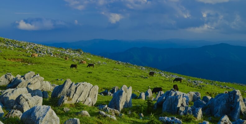
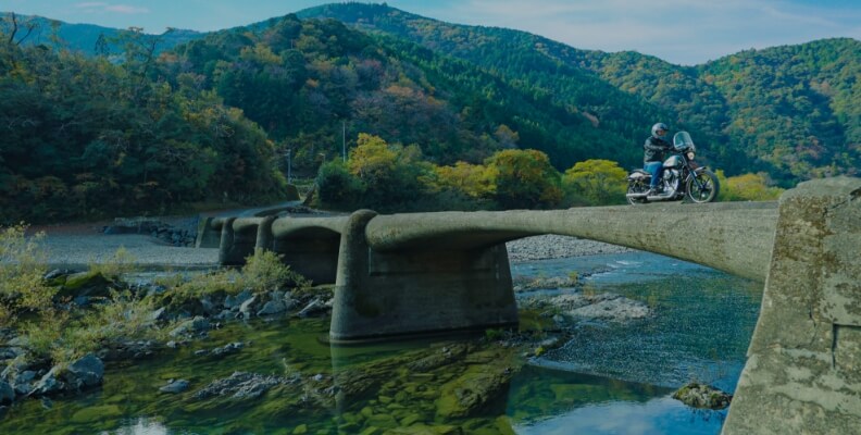
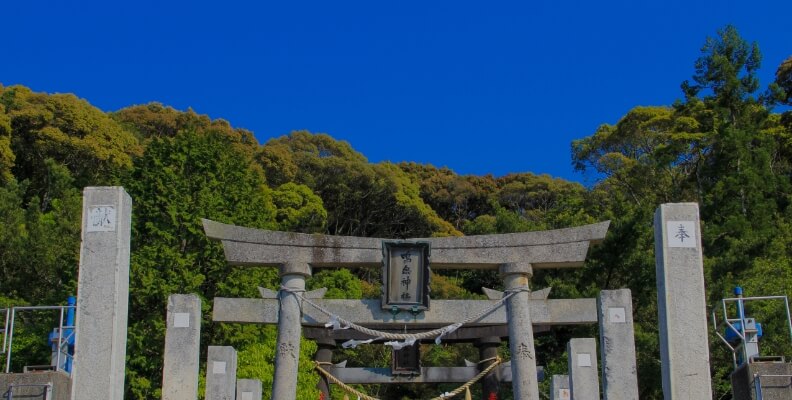
The Shimanto River originates from Irazuyama in the town of Tsuno and traverses the Oku Shimanto area. The river basin landscape is one of harmony between human life and lush nature, with the submersible bridges being particularly symbolic. Here, we present submersible bridges of varying shapes and sizes along with places to visit in the river basin from upstream to midstream.
- Shimanto River Headwaters, the starting point of Japan’s last pristine river
- The Takahi Submersible Bridge, the first submersible bridge at the top of the Shimanto River
- Kumaaki Spring, a spring for those in the know along the banks of the Shimanto River
- Kumaaki Submersible Bridge, a submersible bridge that complements the tranquil scenery of the upper reaches of the river
- Nagano Submersible Bridge, the only submersible bridge that city buses can take
- Ittohyo Submersible Bridge, the oldest submerged bridge on the Shimanto River
- Over 100 meters in length. Shimizu Ohashi Bridge, the longest submersible bridge in the upper reaches
- Wakai Submersible Bridge, a symbol cherished and preserved by the community
- A spot along the river famous for cherry blossoms. Iejigawa Park, where the magical night-time cherry blossoms are a must-see
- Mukai-Hirose Submersible Bridge, the closest submerged bridge to the surface of the water
- Jogu Submersible Bridge, rooted in local lifestyle and culture
- Kamioka Submersible Bridge (Mukaiyama Bridge), known for its distinctively beautiful arch
- Satokawa Bridge, a submersible bridge that has withstood countless floods and remains in changed form
- Shintani Submersible Bridge, an elegant presence that has been featured in a JR poster
- Mishima Submersible Bridge No. 1, a rare bridge that runs alongside a railway bridge
- Mishima Submersible Bridge No. 2, connecting to the sandbank with Bridge No. 1
- Koinobori Park, where carp streamers swim gallantly above the Shimanto River
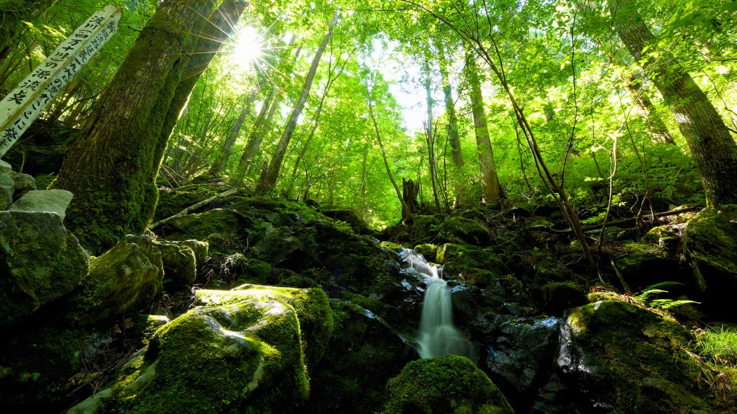
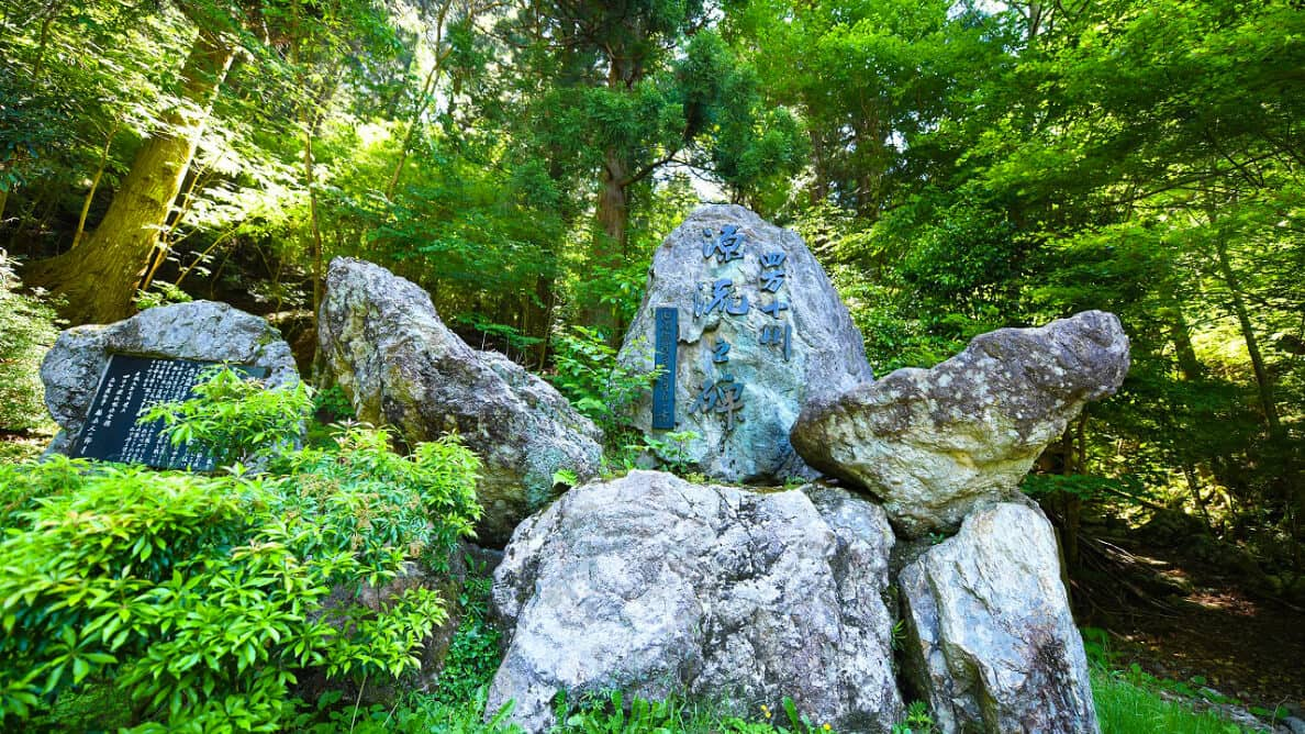
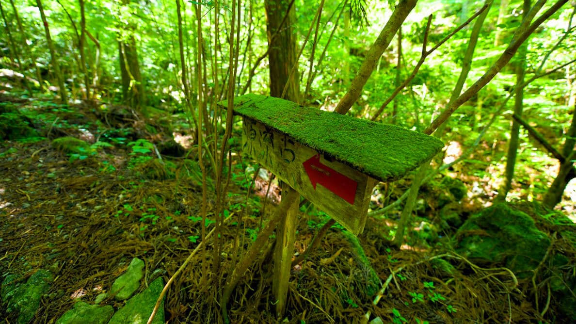
Shimanto River Headwaters, the starting point of Japan’s last pristine river
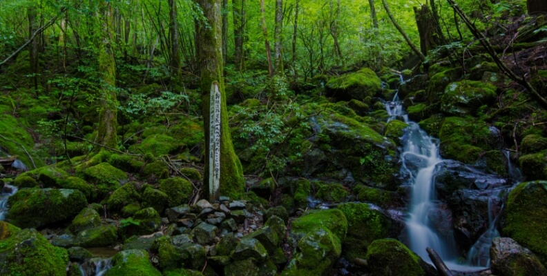
The Shimanto River, spanning 196 km, starts in Irazuyama, located south of the Shikoku Karst at an elevation of 1,300 meters. The Shimanto River headwaters can be reached through a 25-minute walk along a trail that starts near the Shimanto River Headwaters Monument, the last point accessible by car. With moss-covered fallen trees and rocks over which clear water flows, this landscape feels truly sacred. Surround yourself in negative ions as you walk through the forest in a special place where you can take time to reflect on the long journey along the Shimanto River that starts here.
The Takahi Submersible Bridge, the first submersible bridge at the top of the Shimanto River
Located about 18 km from the Shimanto River headwaters in Onomiomata in the town of Nakatosa, the Takahi Submersible Bridge is the uppermost submersible bridge along the main stream of the Shimanto River and is also known as Omata Submersible Bridge. The part of the foundation visible in the water is the remains of a water intake weir, a facility that draws water for agriculture from the river. Built atop an old weir after a new water intake weir was constructed downstream around 1965, this shape is unique among submersible bridges. The presence of a weir downstream also creates calm rapids, making the bridge appear to stand on a mirror-like water surface, a characteristic of the Takahi Submersible Bridge. Although it is a small bridge that cars cannot access, it is cherished by the local community as a pathway to the rice fields on the opposite bank.
 Bridge length: 32.0 m, Width: 1.5 m
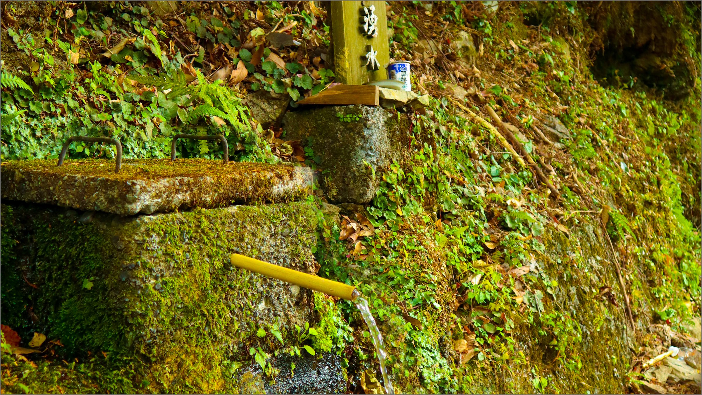
Kumaaki Spring, a spring for those in the know along the banks of the Shimanto River
This spring appears suddenly about 8 km downstream from the Takahi Submersible Bridge along Prefectural Road 19. With no buildings here, spring water flows from between the rocks along the roadside, making it easy to overlook, but a signpost that says “Kumaaki Spring” serves as a landmark. The spring never dries, even in winter, providing soft water that makes tea and coffee brewed with it smooth and delicious, and known among locals and spring water enthusiasts alike, with some people even bringing water tanks to collect its water. Kumaaki Spring Water has been selected as one of Tosa's 40 famous waters. Nearby are companies that bottle natural water drawn from this region, making this a unique spot characteristic of the pristine Shimanto River area.
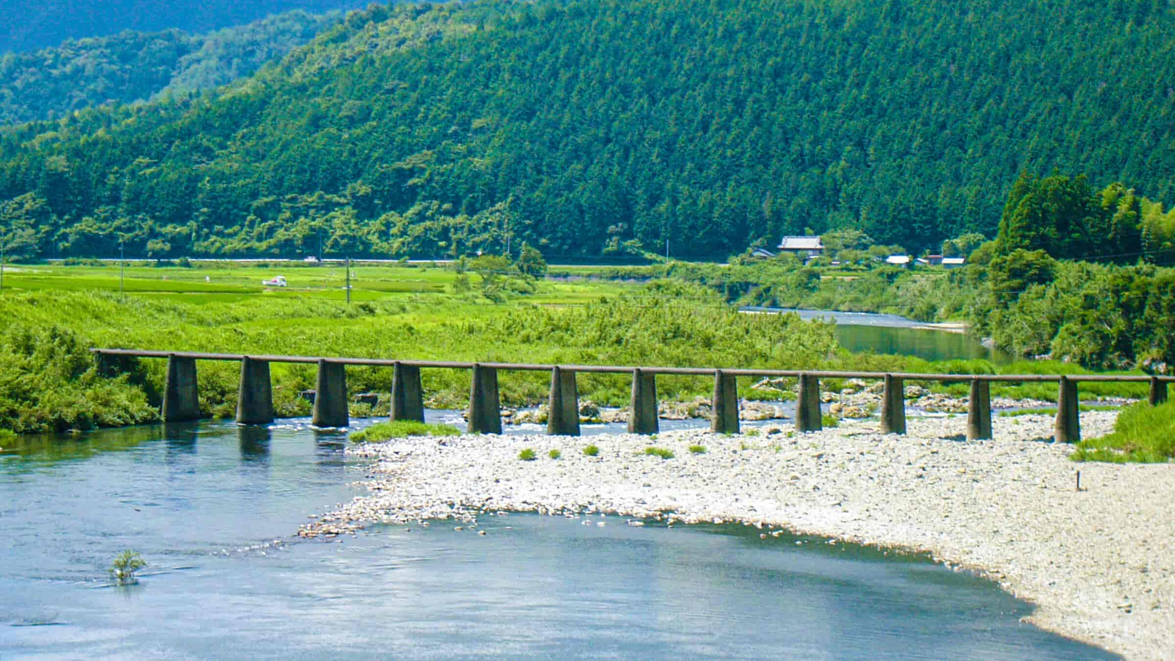
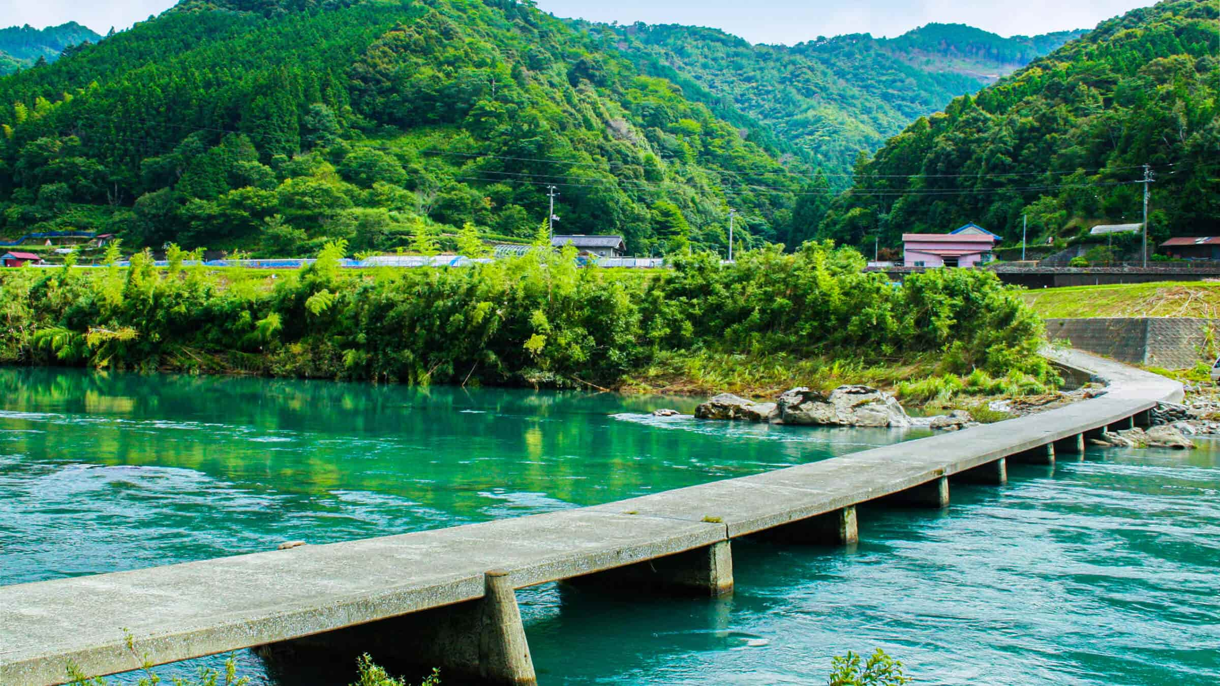
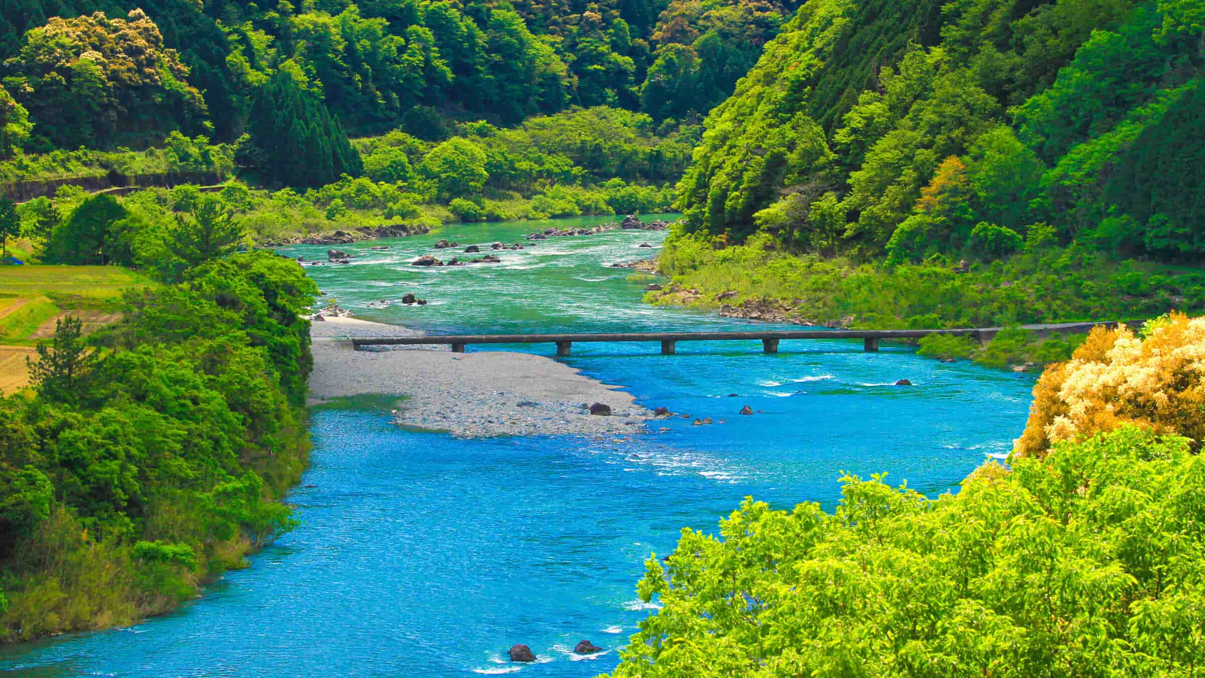
Kumaaki Submersible Bridge, a submersible bridge that complements the tranquil scenery of the upper reaches of the river
A highlight to look out for with this upstream submersible bridge is the narrow river width and its relatively small submersible bridge, as well as the idyllic landscape woven by lush mountains and fields. The second bridge downstream from the spring waters of Kumaaki, the Kumaaki Submersible Bridge, built in 1964, serves as an essential lifeline connecting the village of Kumaaki along the prefectural road to the village of Naro across the river and permits vehicle traffic. The area near the bridge is shallow and anglers are often seen here fishing for sweetfish, and every April, this place serves as the venue for the Onomi Amego Fishing Festival, making it a beloved spot for people to relax and gather.
 Bridge length: 49.0 m, Width: 3.0 m, Cars allowed
Nagano Submersible Bridge, the only submersible bridge that city buses can take
Constructed in 1965, Nagano Submersible Bridge spans a shallow area similar to Kumaaki Submersible Bridge, offering views typical of the upper reaches, with a slight difference in bridge height. Nagano Submersible Bridge is taller, offering slightly more thrill from the view atop the bridge. It also allows vehicle traffic and connects the prefectural road to villages, and is the only submersible bridge on a bus route. Witnessing a bus fill the width of the bridge as it crosses is a rare sight you may want to capture in a photograph. You could also try taking the bus to experience the view from the submersible bridge.
 Bridge length: 32.0 m, Width: 1.5 m, Cars allowed
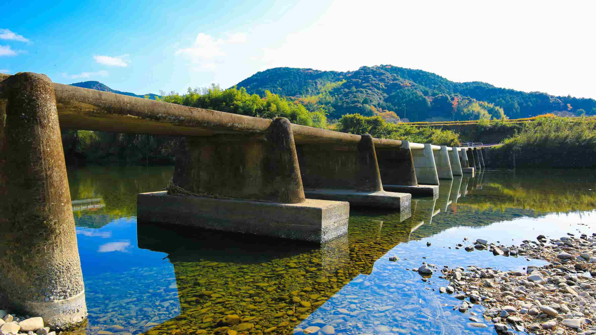
Ittohyo Submersible Bridge, the oldest submerged bridge on the Shimanto River
Built in 1935, Ittohyo Submersible Bridge is the oldest existing submersible bridge on the Shimanto River and has been designated a national registered cultural property. It has a distinctive structure in which there are no piers in the center, with thick piers and a bridge that is thicker toward the center. The reason it has no piers in the center is apparently because they could not reach the bedrock, and this, combined with a shape that grows more spacious toward the center, creates the characteristic shape of Ittohyo Submersible Bridge. While it no longer plays a major role as a pathway in daily life now, in summer, it is a place where children play in the river, with children diving into the river from this beloved bridge a common sight. Its history and presence make this a symbol of the submersible bridges on the Shimanto River.
 Bridge length: 60.6 m, Width: 2.0 m
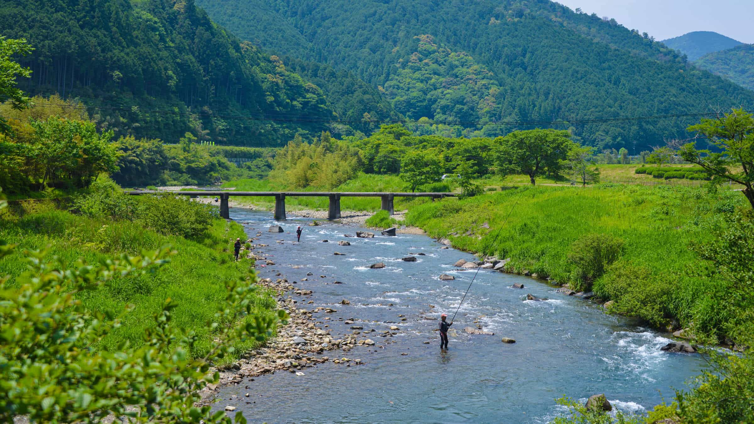
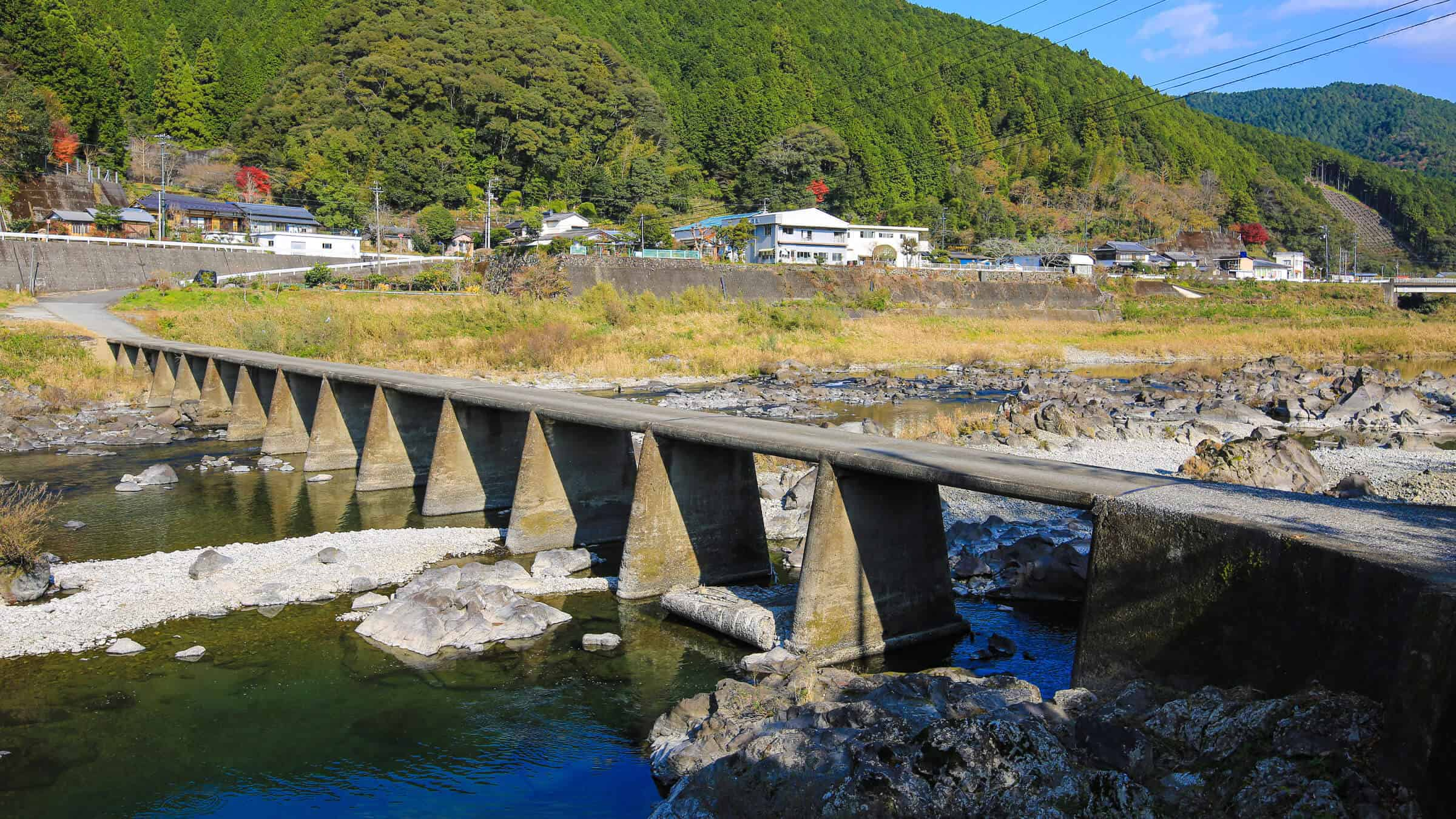
Over 100 meters in length. Shimizu Ohashi Bridge, the longest submersible bridge in the upper reaches
Just downstream of Ittohyo Submersible Bridge is Shimizu Ohashi Bridge, the longest bridge in the upper reaches at a total length of 102.1 meters. Built in 1965, it is also known as the Shimizugase Submersible Bridge. This bridge is characteristic for its length and height, which requires courage to cross. However, due to its height, it rarely submerges, even in high water. Like Ittohyo Submersible Bridge, it is not often used as a pathway in daily life now, but Shimizu Ohashi has served as a vital lifeline for the people in this region in the past when frequent flooding washed away other bridges and caused accidents in the past. The area near the bridge is a popular spot for catching sweetfish, and during the season, the river is dotted with anglers, while spectators gather on the bridge, creating a tranquil scene.
 Bridge length: 102.1 m, Width: 2.8 m
Wakai Submersible Bridge, a symbol cherished and preserved by the community
About 15 km downstream from the Shimizu Ohashi Bridge near the Tosa Kuroshio Railway Wakai Station is Wakai Submersible Bridge. The new concrete in the center is a painful reminder of the destruction caused by torrential rains from Typhoons 11 and 12 in 2014. Built in 1958, Wakai Submersible Bridge served as a pathway for daily life for a long time but, as a road that does not permit vehicle traffic, fell into disuse and thus was not covered by the Shimanto River Submersible Bridge Preservation Guidelines. Despite requests from local residents for preservation and repair, the bridge was damaged by the aforementioned torrential rains and most of it was washed away, with its painful state even featured in the news. However, afterward, as part of a disaster recovery project, the bridge was restored in 2016 and has since become eligible for preservation, and is cherished as a symbolic presence in the local area to this day.
 Bridge length: 85 m, Width: 2.5 m
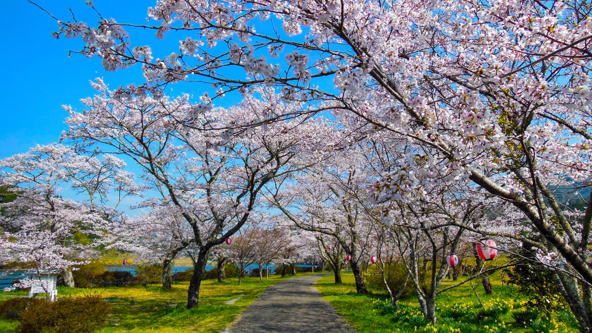
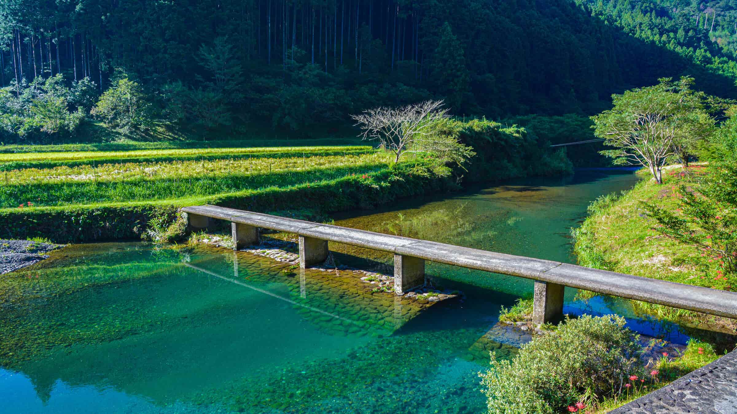
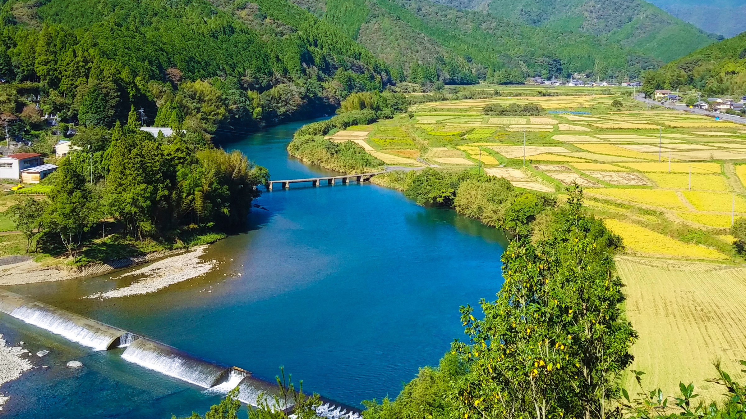
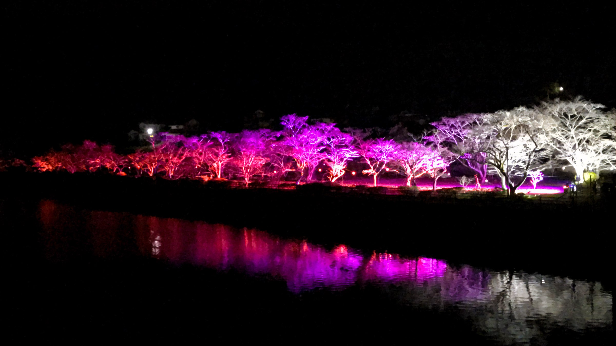
A spot along the river famous for cherry blossoms. Iejigawa Park, where the magical night-time cherry blossoms are a must-see
Further downstream in the Iejigawa area is the Saga Weir, commonly known as the Iejigawa Dam. A dam in the Shimanto River, a river without dams? you may ask, but only structures taller than 15 meters are called dams, and at 8.0 meters, Iejigawa Dam is not officially a dam. Iejigawa Park, built along its banks, is a premier cherry blossom spot in the Oku Shimanto area, where about 300 cherry trees bloom in spring. Not only can you see cherry blossoms up close along the promenade, but you can also take in views of the Shimanto River and cherry blossoms from different angles, including from atop the Iejigawa Dam and from the opposite bank. The area is lit during cherry blossom season, letting you enjoy a magical scenery of cherry blossoms floating in the dark night and reflected on the surface of the river.
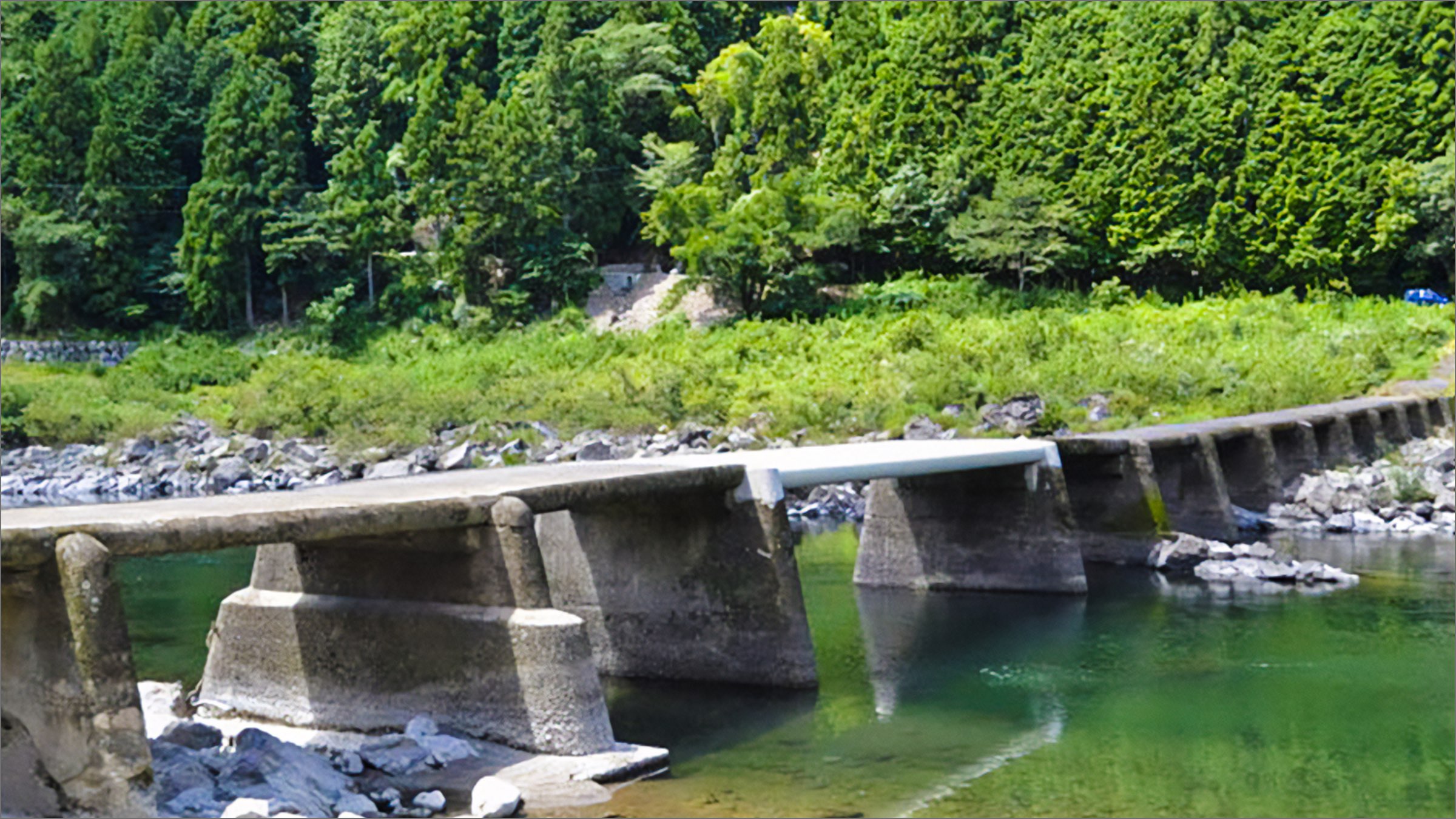
Mukai-Hirose Submersible Bridge, the closest submerged bridge to the surface of the water
Just downstream of the Iejigawa Dam is the Mukai-Hirose Submersible Bridge. Built in 1963, this bridge is known as "the lowest submersible bridge on the main stream of the Shimanto River" due to reduced water flow in the section up to the confluence with the Yusuhara River, the largest tributary of the Shimanto River, following the completion of the Iejigawa Dam in 1937. Its low height makes the flowing water surface feel close enough to touch, offering a unique and powerful view and experience of the river's flow unlike what you will find at other submersible bridges. This submersible bridge allows for vehicle traffic even today, and the sight of cars passing just above the surface of the water is a spectacle unique to this bridge. Despite being in an area of low water flow, its low height means it often submerges during high water.
 Bridge length: 62.1 m, Width: 2.5 m, Cars allowed
Jogu Submersible Bridge, rooted in local lifestyle and culture
Jogu Submersible Bridge is known for its rugged landscape, standing amid exposed rocks. It is characterized by its tall piers and the narrow spaces between them. Since its construction in 1957, this submersible bridge has played an active role in everyday life, connecting the village of Kitanogawa on the right bank to the village of Jogu on the left bank upstream to downstream, allowing car traffic. There is a school in Kitanogawa, meaning you can see peaceful scenes of children crossing the bridge on their way to school. Although its official name is Jogu Bridge, it is called the Jogu Submersible Bridge to distinguish it from another bridge of the same name located just upstream (a regular, large bridge).
 Bridge length: 85.1 m, Width: 2.9 m, Cars allowed
Kamioka Submersible Bridge (Mukaiyama Bridge), known for its distinctively beautiful arch
About 5 kilometers downstream from Jogu Submersible Bridge in the Kamioka district is the Kamioka Submersible Bridge, officially named Mukaiyama Bridge. The defining feature of this bridge is its shape, which stands out at first glance. The series of arch-shaped girders convey modernity and beauty, making it arguably the most distinctive submersible bridge in the Oku Shimanto area. Constructed in 1963, the Kamioka Submersible Bridge was actually modeled after the Kuchiyanai Submersible Bridge in the city of Shimanto built in 1955 and is often referred to as its sister bridge. While the Kamioka Submersible Bridge is certainly unique, its distinctiveness is not just for show. Given the rapid currents in this area, the curves were apparently incorporated to consider resistance to water during flooding, meaning that its beautiful design is also structurally sensible.
 Bridge length: 60.0 m, Width: 3.7 m, Cars allowed
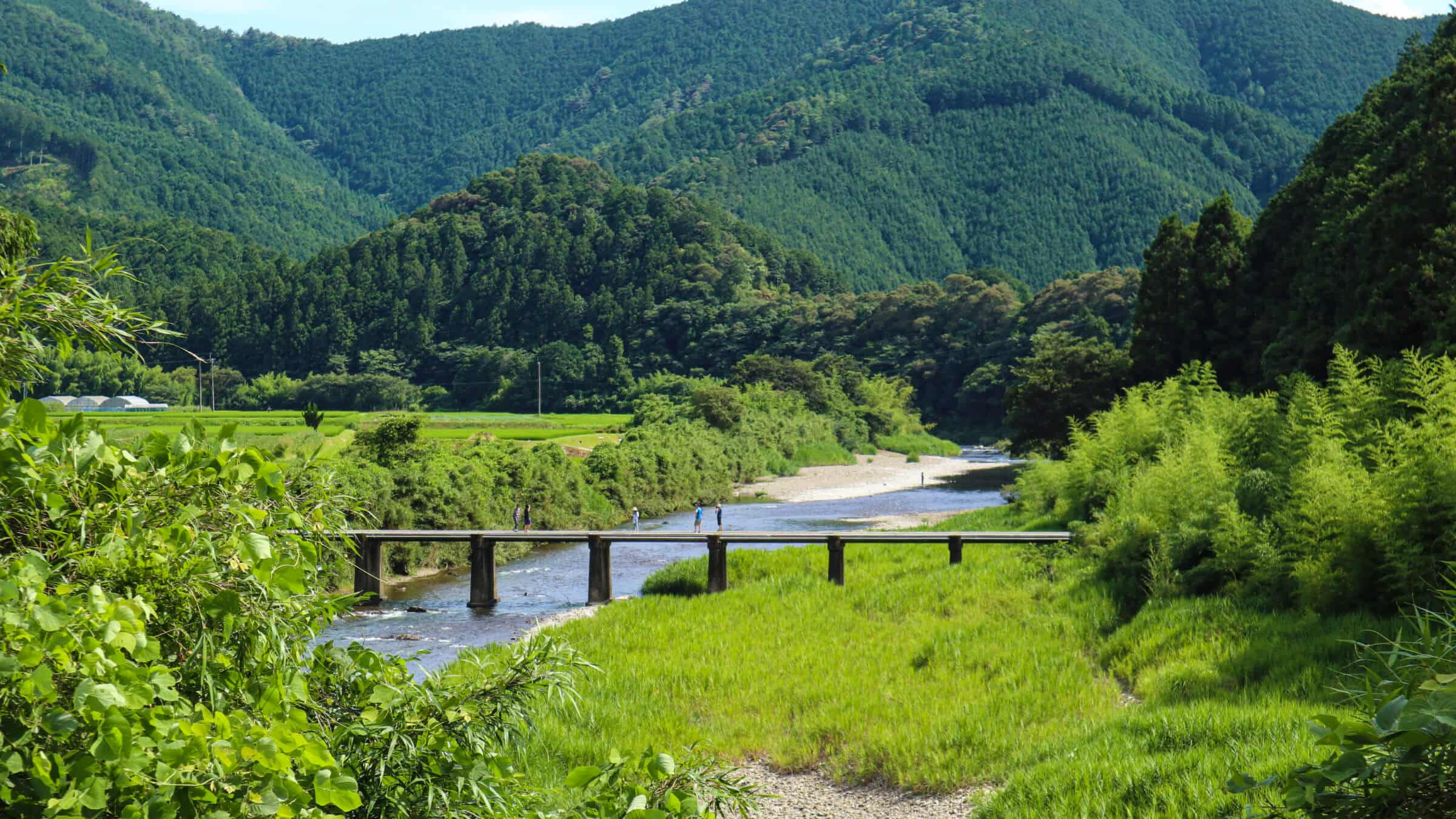
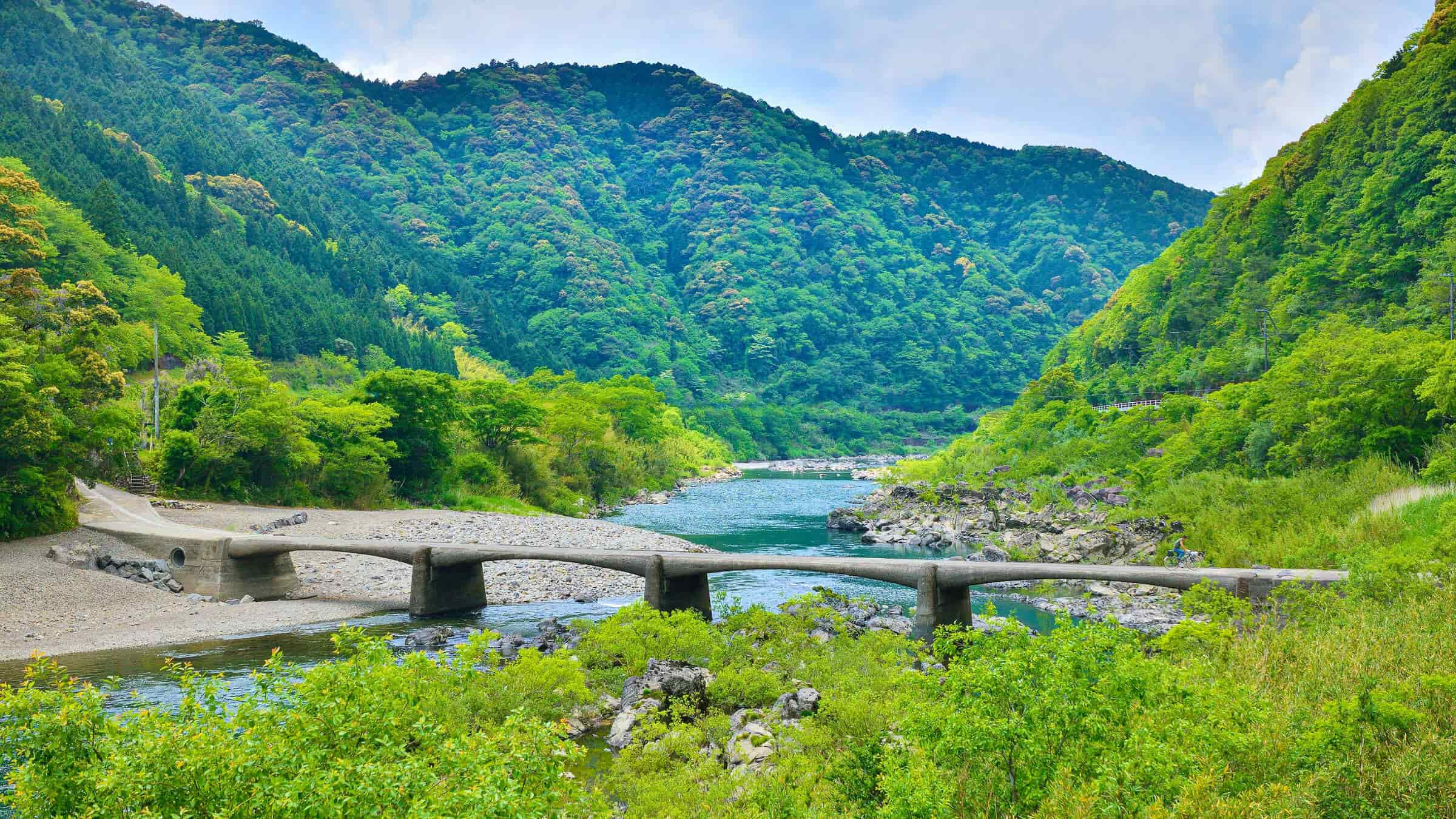
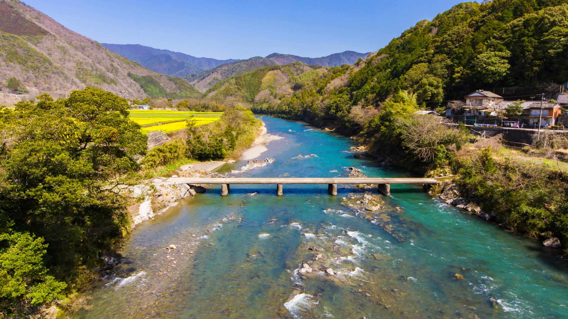
Satokawa Bridge, a submersible bridge that has withstood countless floods and remains in changed form
Built in 1954, Satokawa Submersible Bridge is the third oldest on the Shimanto River. The bridge was hit by floods when it was first built, with the girders and piers in the central portion often washed away. Removing one of the thirteen piers located in the center eventually stopped it from washing away. However, in 2011 and 2014, torrential rains caused the central girders to wash away again, and the bridge was met with several disasters in a row. However, it has since been repaired and restored to its original appearance. While the Satokawa Submersible Bridge has been hit by several disasters, the large riverbed nearby has made it a popular spot for river play and camping in the summer, when it is bustling with people. Despite frequent flooding, the landscape of the Shimanto River remains fiercely protected.
 Bridge length: 84.0 m, Width: 3.0 m
Shintani Submersible Bridge, an elegant presence that has been featured in a JR poster
Kayabukute Submersible Bridge, also known as the Shintani Bridge, located in the village of Kayabukute in the town of Shimanto, was built in 1970. Unlike the stretch from the Jogu Submersible Bridge to the Satogawa Submersible Bridge upstream, this bridge stands in gentle currents. It is characterized by its graceful and somehow tranquil shape. In 1997, it was featured in JR’s "Full Moon Poster" and was also visited on location by the actor Yuzo Kayama and his wife. Although it is a little difficult to find because it is off the national road, the landscape with few man-made structures is part of its charm. The surrounding riverbed is wide, making it ideal for river play, and it is worth stopping by to see this submersible bridge from different angles.
 Bridge length: 84.0 m, Width: 3.0 m, Cars allowed
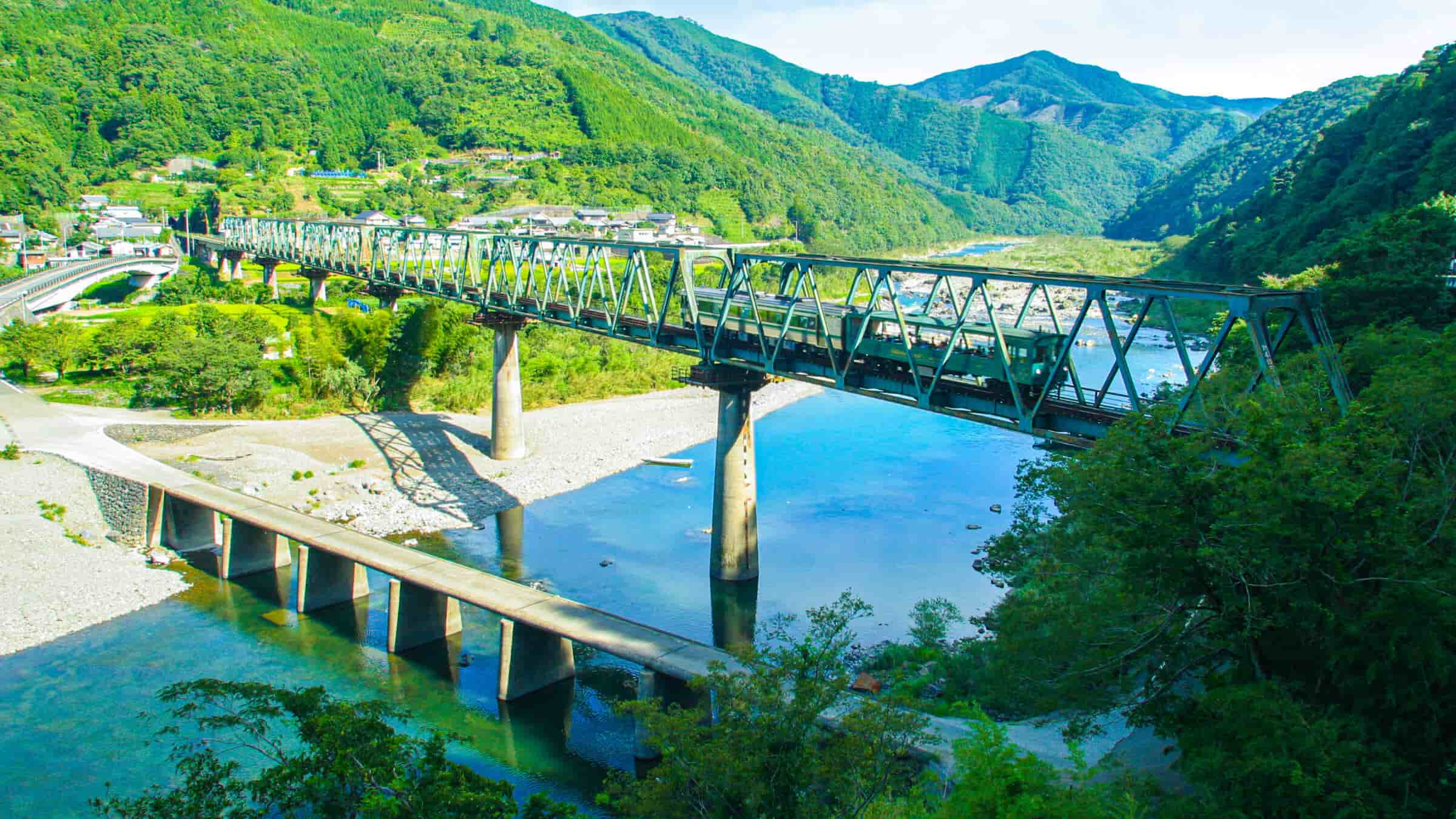
Mishima Submersible Bridge No. 1, a rare bridge that runs alongside a railway bridge
The last two submersible bridges in the Oku Shimanto area are sister bridges that connect to Mishima, a sandbank. One of them is the Mishima Submersible Bridge No. 1, built in 1966. The only bridge that crosses to Mishima from the right side of the bank where there is a national route, once you cross to Mishima, go straight and it connects to a non-submersible bridge crossing to the opposite bank. A highlight of this bridge is the view of the JR Yodo Line railway bridge running diagonally above it. With luck, you can see the railway hobby train modeled after the Shinkansen or a trolley train running. However, since trains are infrequent here, those who wish to see a train may want to check the timetable. Mishima also has a campsite equipped with bungalows and tent sites, making this a place where you can enjoy rafting and other activities.
 Bridge length: 77.0 m, Width: 3.3 m, Cars allowed
Mishima Submersible Bridge No. 2, connecting to the sandbank with Bridge No. 1
Mishima Submersible Bridge No. 2 and 3 connect Mishima and the left bank and were built in 1967, a year after Mishima Submersible Bridge No. 1. Before these two bridges were built, there was a ferry in operation, and after their construction, agricultural work in the fields of Mishima reportedly improved significantly. Vehicle traffic is permitted to this day, but since the construction of Todoro Bridge, an extraction bridge that extends from the Mishima Submersible Bridge No. 1, there has been less vehicle traffic. We also recommend the view from the Todoro Bridge, looking diagonally down at the submersible bridge over the Shimanto River and the pastoral landscapes of Mishima. Downstream, the river gradually widens, and the large submersible bridges you will find there are worth a look, but be sure to check out the many different faces of the Shimanto River and its submersible bridges in the upper and middle reaches.
 Bridge length: 55.0 m, Width: 3.3 m, Cars allowed
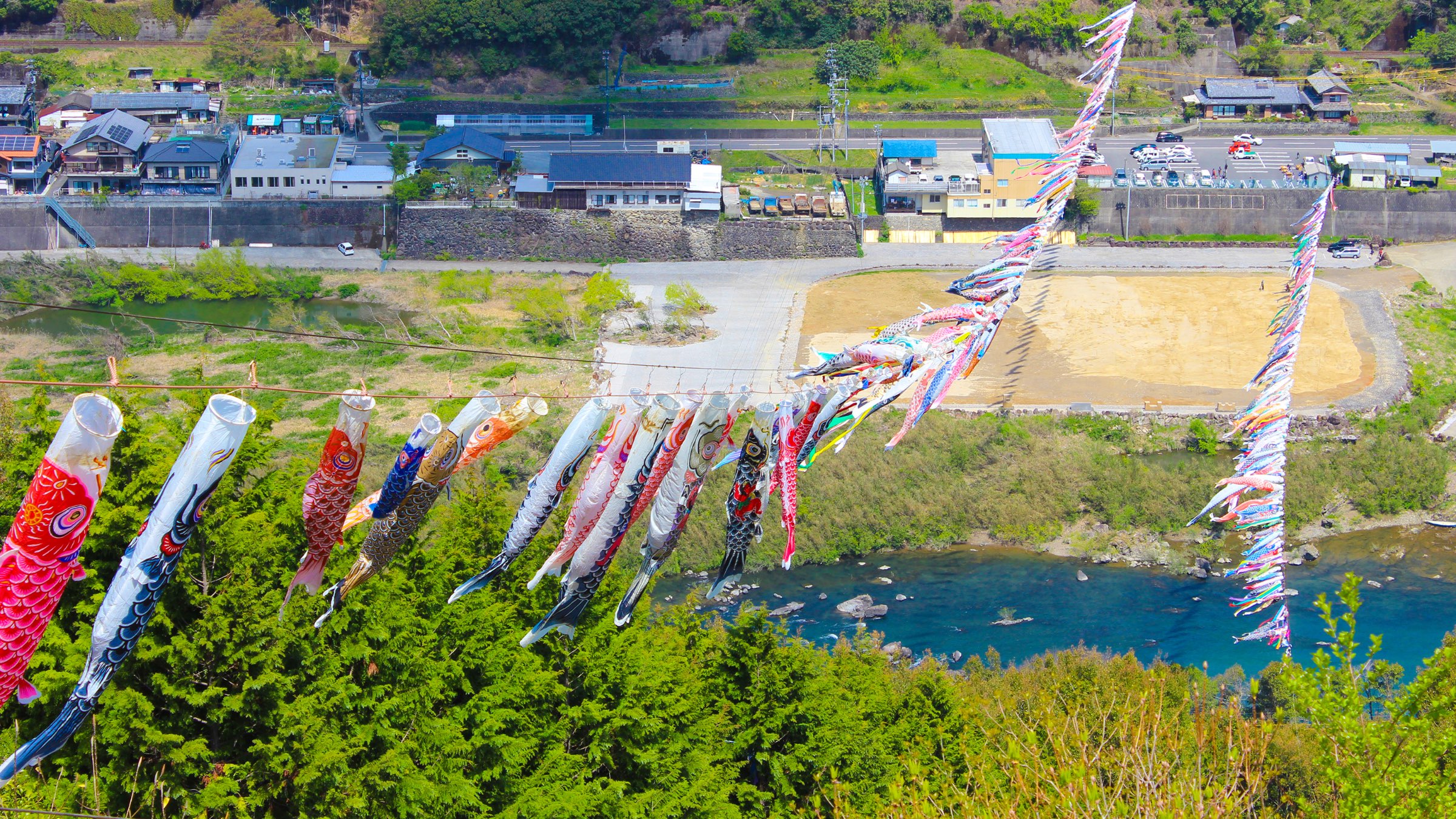
Koinobori Park, where carp streamers swim gallantly above the Shimanto River
From April to May, when the mountains in the Towa area of Shimanto are cloaked in fresh verdure, a magnificent sight of 500 carp streamers swimming gallantly above the Shimanto River can be seen. While similar displays exist nationwide, Towa is in fact the birthplace of this tradition of carp streamers over the river. It all began in 1974 when local youths hung 50 carp streamers across the river for the children, and when this was featured in the media, carp streamers were sent from all over Japan, creating the scene we see today. Koinobori (“Carp Streamer”) Park, built as a place to view these carp streamers over the river, lets visitors watch the carp streamers swimming directly overhead, with events held during Golden Week. During this period, an observation deck is built, offering a powerful view from above like that in the photograph.